There’s no substitute for boots on the ground – but remote sensing can make every visit count. In collaboration with Sports Turf Technology, this article explores how NDVI and satellite imagery are transforming turf management by identifying stress early and directing attention where it’s needed most.
Article republished with permission from Irrigation Australia. Article was originally published in the Spring 2024 edition (Issue #78) of The Overflow magazine, the quarterly publication of Irrigation Australia (WA Region).
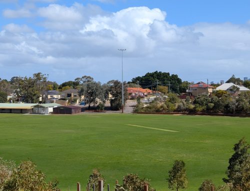
People on the ground – there’s no substitute! But how do we make the best use of our precious time identifying the areas that need attention? Remote sensing technologies, particularly the Normalised Difference Vegetation Index (NDVI), offer powerful tools to help turf managers efficiently identify areas that need attention throughout the entire year. It is also particularly useful for the irrigation season to assist in identifying whole or sections of sports fields that have become drought stressed before the turf becomes totally brown.
Understanding NDVI
NDVI is a remote sensing metric used to assess the health and vigour of vegetation, including turfgrass. It works by analysing the difference between red and near-infrared (NIR) light reflected by plants. Healthy, green vegetation absorbs more red light and reflects more NIR light, resulting in a higher NDVI value. In contrast, stressed or unhealthy vegetation reflects more red light and less NIR light, yielding a lower NDVI value. This simple yet effective index allows turf managers to gauge the condition of large areas quickly and accurately.
Benefits of Using NDVI for Turf Monitoring
- Early Detection of Stress: NDVI can identify signs of stress in turfgrass before they become visible to the naked eye. This early detection allows for timely intervention, preventing further damage and reducing the need for costly treatments.
- Efficient Resource Management: By monitoring NDVI, turf managers can optimise water usage, fertiliser applications, and pest control measures. This helps to conserve resources and reduce environmental impact.
- Pest and Disease Management: NDVI can aid in identifying areas of pest or disease infestation. By tracking changes in NDVI values over time, turf managers can pinpoint problem areas and take appropriate action.
- Irrigation Management: NDVI provides early warning of potential irrigation-related problems in the field such as poor distribution uniformity, burst pipes or blocked sprinklers.
- Fertiliser Optimisation: NDVI can help determine the appropriate amount and timing of fertiliser applications. By assessing the nutritional status of turfgrass based on NDVI values, managers can avoid over-fertilisation and minimise nutrient leaching.
How NDVI is Used
NDVI data can be collected from various sources, including satellites, drones, and handheld devices. The data is then processed to create NDVI maps or time-series analyses. These tools provide valuable information on the spatial and temporal variability of turfgrass health.
- Satellite Imagery: High-resolution satellite imagery can be used to monitor large areas of turfgrass, such as golf courses, sports fields, and parks.
- Drone Imagery: Drones equipped with NDVI sensors offer an option for monitoring smaller areas, such as residential lawns or commercial landscapes.
- Handheld Devices: Portable NDVI meters can be used to measure the health of individual plants or small patches of turfgrass.
Satellite Imagery in Turf Management
Satellite imagery, particularly NDVI, is a powerful tool in managing turf quality in public open spaces. The Sentinel-2 data set is publicly available and free for anyone to use. This satellite passes overhead approximately every 5 days, with images featuring 10-metre pixel resolution, making it suitable for monitoring very large areas where frequent updates aren’t critical.
For turf managers requiring more detail, Planet Labs provides cost-effective daily satellite imagery with a resolution of 3.7-metre pixels (Figure 1). Both Sentinel-2 and Planet data are seamlessly integrated into SWAN Systems’ irrigation management software, which offers a suite of analytical tools.

Figure 1: NDVI map of four sports ovals at a high school.
These tools help analyse the imagery and derive insights that can inform management decisions, including identifying locations that may need on-site visits (Figure 2).

Figure 2: Detection of leak using NDVI.
SWAN enables you to select one or more specific parts (Site Health Areas) of a field for more in-depth analysis. In Figure 3, the icons on the ovals indicate Site Health Areas that are within, above, or below the desired target zone (respectively green, blue, or amber). Clicking on one of these icons opens a chart showing the NDVI trend over time, as well as the variability of the pixels within the chosen Site Health Area.

Figure 3: NDVI data over 12 months.
Temporal analysis of NDVI (Figure 4) can reveal stress from drought, disease, or pests. It can help turf managers evaluate the effectiveness of irrigation and maintenance. It can also help pinpoint problem areas and assess the impact of seasonal changes or specific events on turf quality.

Figure 4: Temporal Variation (change over time).
Addressing Challenges
While NDVI offers many benefits, there are challenges to using it for remote turf monitoring. Satellite imagery can be affected by cloud cover, haze, and smoke, which can obscure or distort the data. Additionally, interpreting NDVI imagery requires experience, though modern tools have made this task more accessible.
It’s important to remember that remote monitoring with NDVI should complement, not replace, on-the-ground assessments. Partnering with experts can enhance the effectiveness of this technology. Sports Turf Technology, in collaboration with SWAN Systems, is helping public open space and sports turf managers in Western Australia harness the full potential of these valuable tools, ensuring they get the most benefit from their time on the ground.
By integrating remote sensing with traditional turf management practices, turf managers can achieve a more precise, efficient, and sustainable approach to maintaining public open spaces, making every on-site visit count.